Най-новият разказ на Давич Качон, придружен от страхотни снимки и видеоклип на Фернандо Мармолейо, ни среща с две интересни места в испанския регион Cáceres – Ambroz Valley (Valle de Ambroz и Lands of Granadilla (Tierras de Granadilla). Тъй като нямам време да преведа дългия и описателен текст, ще наблегна на визуалните материали, а разказът и информацията за маршрутите публикувам в оригинал на английски – все на някого може да са интересни, че дори и полезни, ако реши да тръгне с велосипед в тази посока…
Destination Spain – Cáceres
Discovering Ambroz and Tierras de Granadilla by bike
Text & riding: david_cachon
Photography: fernando_marmolejo
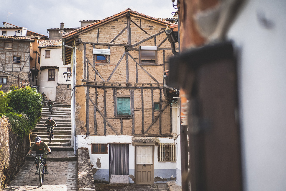
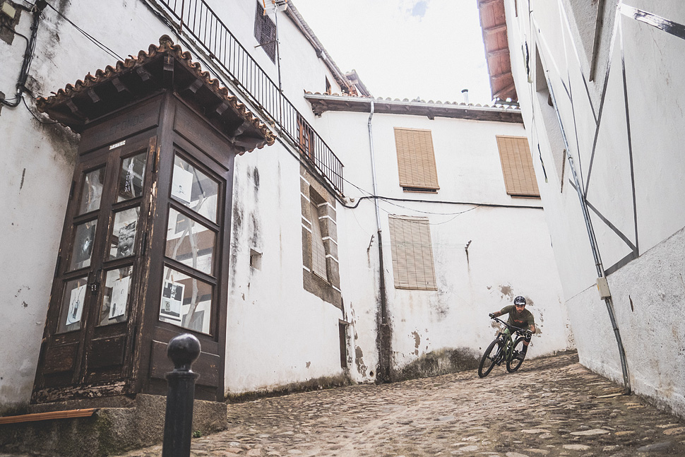
I have been visiting the Cáceres region for several years and I confess that it never ceases to amaze me. This Extremadura province has very special and almost magical corners to get lost on your bicycle, it also offers a rich local gastronomy. The people who inhabit its towns always welcome you with kindness and hospitality, delighted to be able to show the charms that its geography offers to visitors. After having enjoyed such intimate places as: Sierra de Gata, Montánchez, the Jerte Valley, the Monfragüe National Park or the Tajo International area, it was time to set course towards the Ambroz Valley (Valle de Ambroz) and the Lands of Granadilla (Tierras de Granadilla). The rumors of a new mountain bike center and of the trails that the local riders had prepared in the area did not leave me impassive and I decided to pay them a visit and discover of first hand what that area could offer me.
Experience has taught me that starting an adventure like this without the help of the professionals in the area can be a real madness, I always recommend that you get advice and be guided by the true connoisseurs of local trails and trails. In this area there are several local companies that offer you from guided or ski lifts to mechanics and electric bike rentals. In my case I pulled the phone book and decided to meet an old friend, Paco from Bikes at Forest.
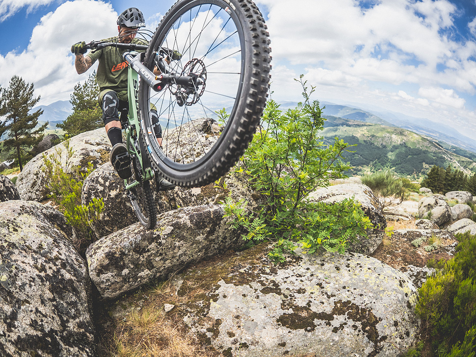
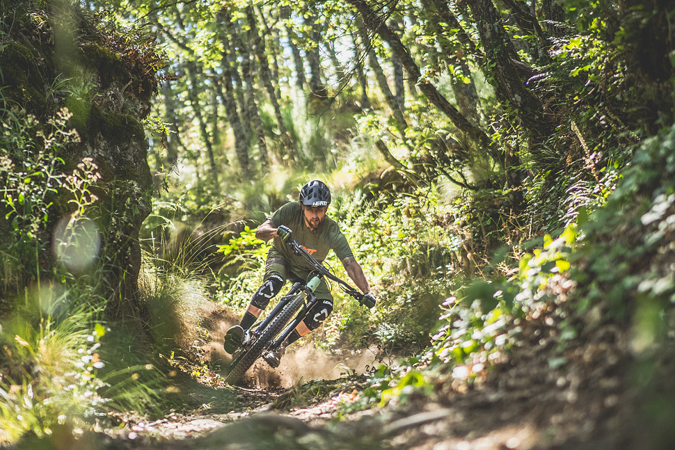
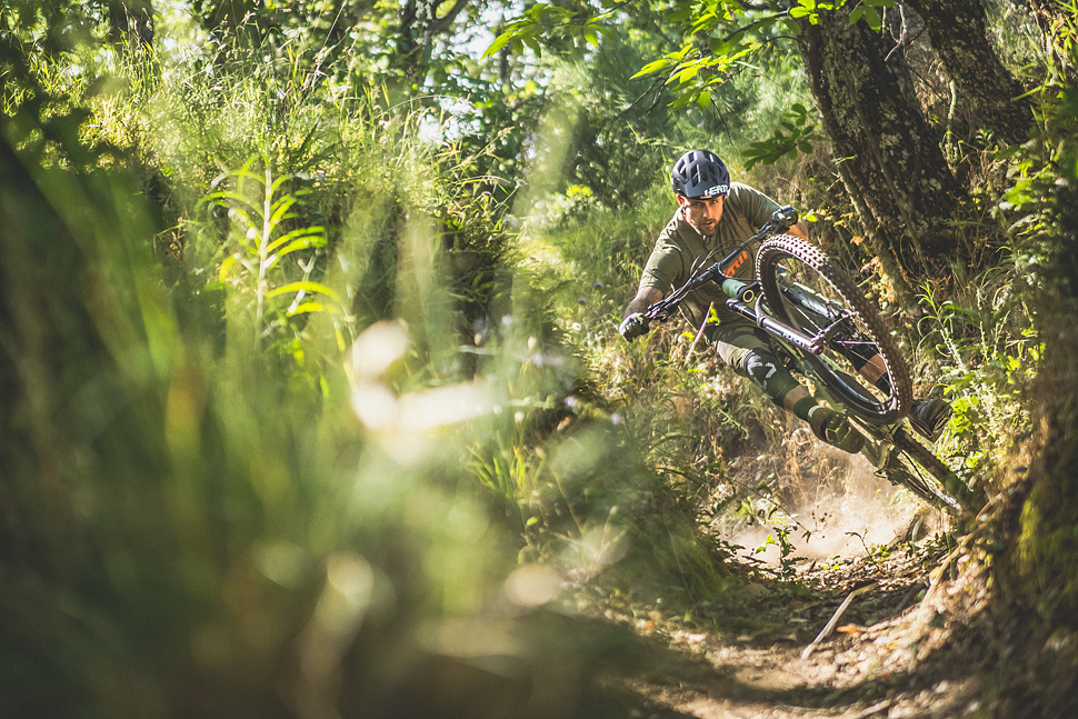
The adventure began as I like, with some cane and large stones, in this way we would begin to know the Ambroz Valley and the Lands of Granadilla, I am sure you will love them.
For any information you can visit the Cáceres Tourism website where you will find a lot of destinations to enjoy two wheels, as well as recommendations to find charming accommodations or recommendations that you can try when tasting local cuisine.
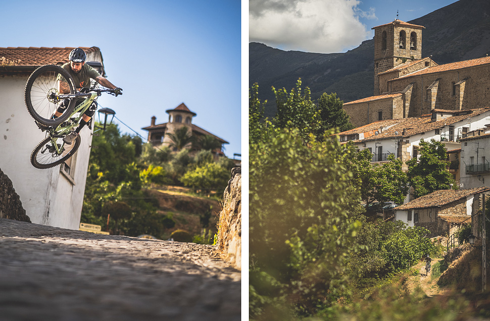
AMBROZ VALLEY (Valle de Ambroz)
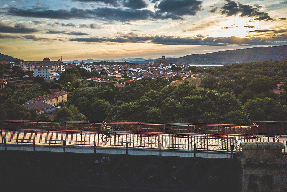
There are many attractions that you can find in the Ambroz Valley: its most important urban nucleus is Hervás, where you can walk the streets of one of the most imposing Jewish quarters in the world. If you go to Baños de Montemayor we recommend its Roman baths … In short, the Ambroz Valley is made up of beautiful villages, incredible landscapes, routes of all kinds, natural pools … Places to get lost and enjoy nature.
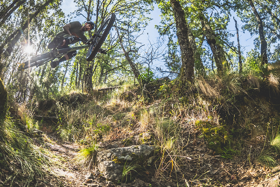
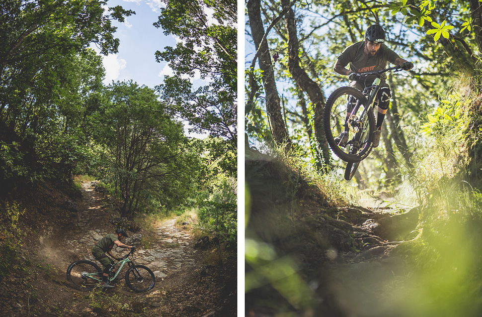
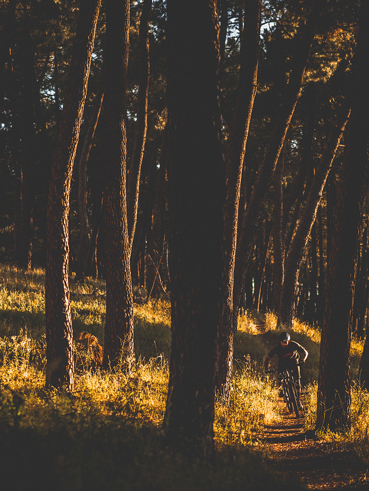
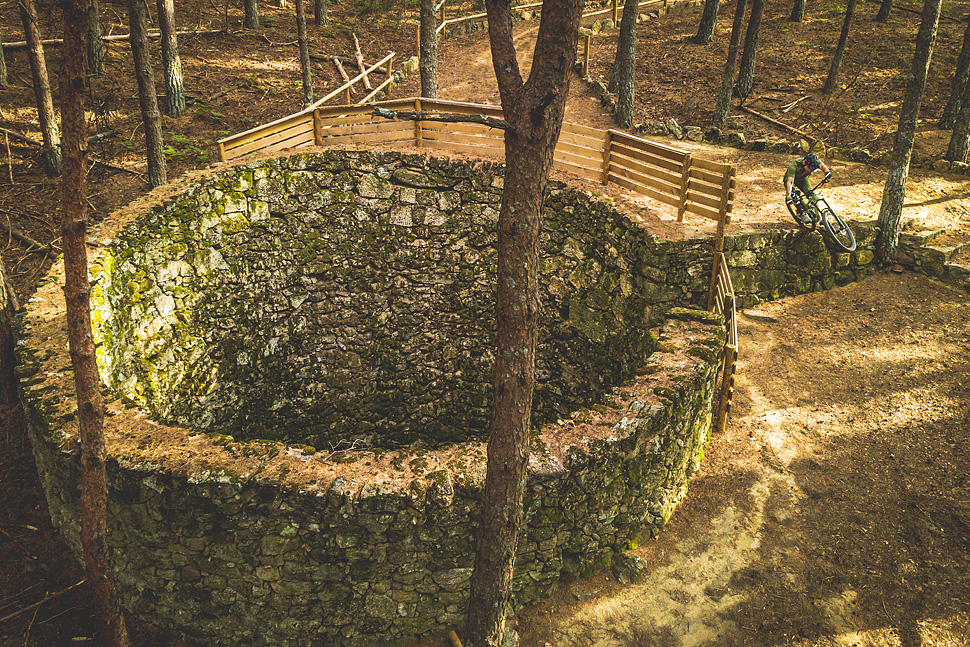
But if there is something that characterizes the Ambroz Valley it is the exuberance of its forests: leafy and coniferous trees play to form a mosaic that, in the autumn months, acquires all its splendor. At the end of October until the end of November, the chestnut forests are tinged with yellow and ocher colors, and the visual spectacle is beautiful. You have to visit the Castañar Gallego area in Hervás, the Castañar del Duque in Aldeanueva del Camino or the Castaños del Temblar in Segura de Toro.
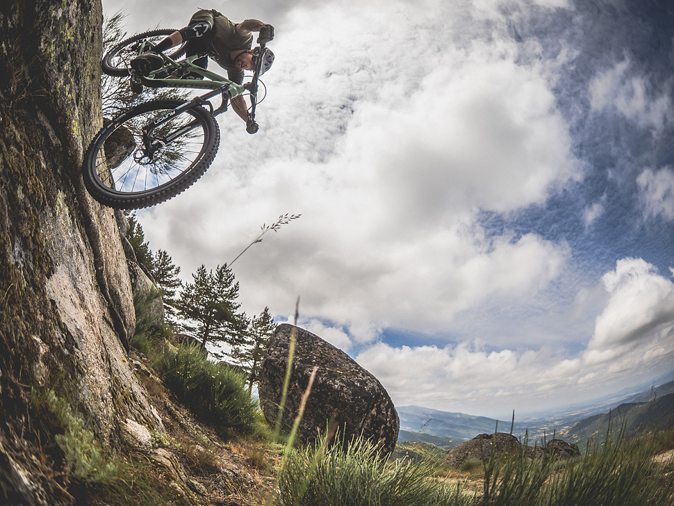
The Ambroz Valley is a place of contrasts, with mountains exceeding 2,000 meters and fertile plains and meadows just 500 meters above sea level, with an abundance of water due to the gorges and rivers that descend rapidly from the mountains.
This difference in heights gives rise to a large unevenness in a relatively short space interval, which means that the network of trails that cross these mountains has excellent downhill sections.
Summary of the technical data of the future Valle del Ambroz MTB Center (not yet marked):
| ROUTE | NAME | TRACK | TRAVEL | DIFFICULTY | DISTANCE |
|
BTT 1 |
Bosques del Ambroz |
Circular |
Hervás – Gargantilla – Segura de Toro – Casas del Monte – Aldeanueva del Camino – Hervás |
Easy (Blue) |
42 Km |
| BTT 2 | Pista Heidi | Circular | Hervás – Hervás | Easy (Blue) | 30,19 Km |
|
BTT 3 |
La Garganta y Gemeloso |
Linear |
Hervás – La Garganta – Baños de Montemayor |
Hard (Red) |
32,13 Km |
|
BTT 4 |
Hacía Abadía por el Embalse de Baños |
Linear |
Baños de Montemayor – Aldeanueva del Camino – Abadía |
Very Easy (Green) |
21,78 Km |
| BTT 5 | Vetones Trail | Circular | Segura de Toro – Segura de Toro | Very Difficult (Black) | 11,45 Km |
|
BTT 6 |
Piedras Labradas |
Linear |
Casas del Monte – Jarilla |
Hard (Red) |
13,42 Km |
| BTT 7 | Romanilla | Linear | Baños de Montemayor – Hervás | Very Easy (Green) | 12,68 Km |
|
BTT 8 |
La bien parada |
Circular |
Aldeanueva del Camino
– Abadía – La Granja – Gargantilla – Aldeanueva del Camino |
Easy (Blue) |
19,94 Km |
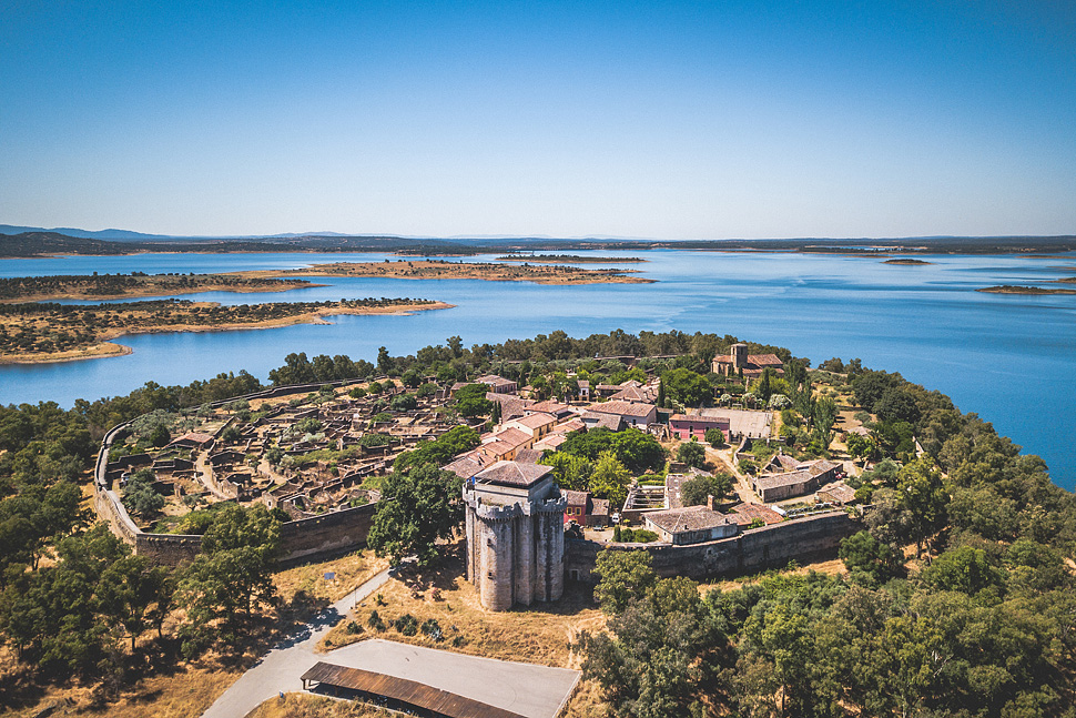
LANDS OF GRANADILLA (Tierras de Granadilla)
The region of the north of Cáceres where the orography of the terrain becomes softer but that hides surprising corners. The variety of landscapes you can find in this territory is overwhelming, from the olive-stained mountain ranges in enclaves with steep slopes, to the plains where the Ambroz and Alagón rivers meet.
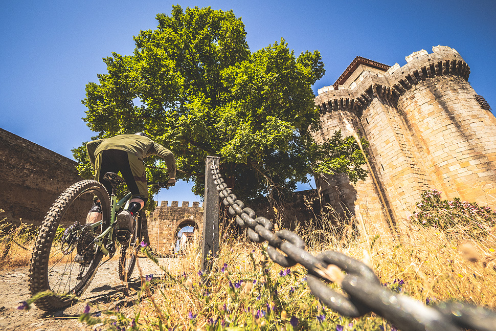
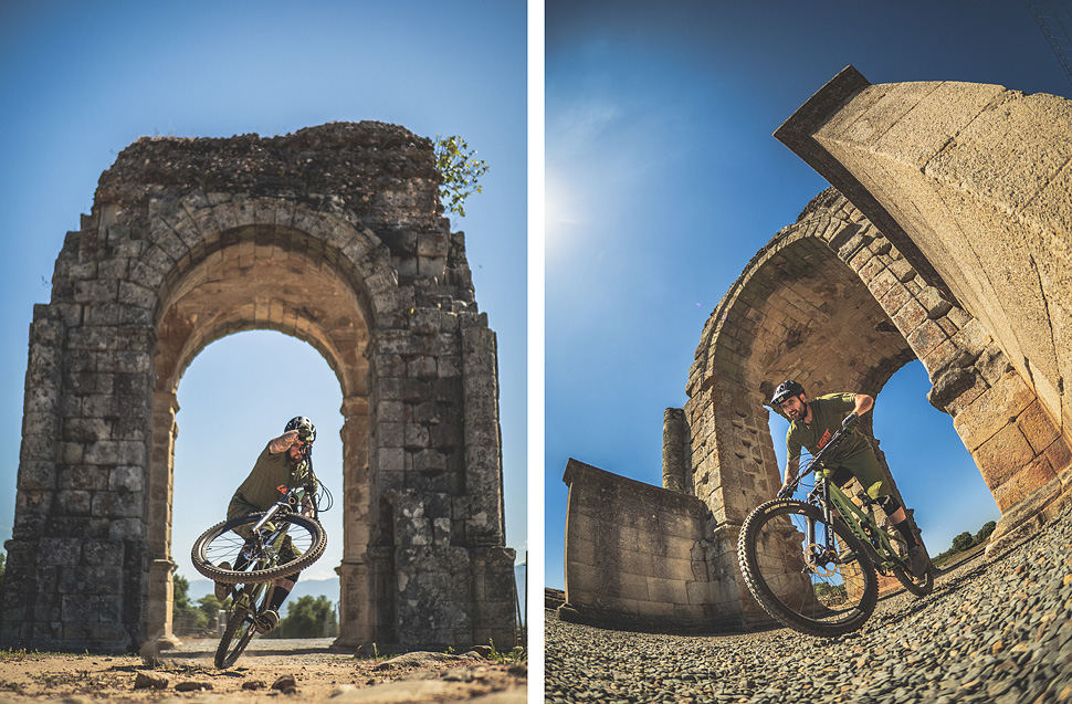
Surrounded by the mountains of Trasierra, Valle del Ambroz and Las Hurdes, this region has always been a place of passage and proof of this is that it is crossed from south to north by the Vía de la Plata, this old road communicated Augusta Emerita (Mérida), capital of the Lusitania province, to end in Asturica Augusta (Astorga). The maximum architectural and archaeological exponent of this crucial Roman communication route is the Arco de Cáparra, which presides over the Roman city of the same name, come to its Interpretation Center to learn more about it.
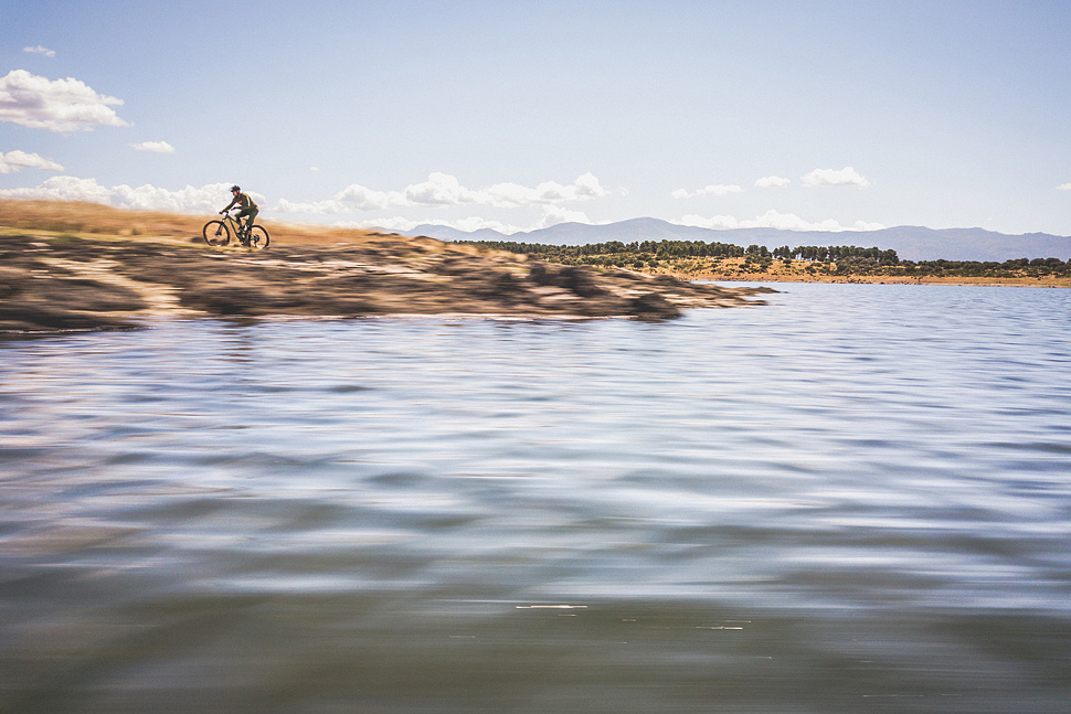
The region has a good number of kilometers of fresh water due to the presence of the enormous sheet of water that draws the Gabriel y Galán reservoir, an exceptional place for practicing water sports and, of course, mountain biking, riding through the shores of its reservoir at sunset when the sun illuminates the mountains that surround the region is quite a spectacle.
Summary of the technical data of the Trasierra-Cáparra MTB Center:
| ROUTE | NAME | TRACK | TRAVEL | DIFFICULTY | DISTANCE |
| BTT 1 | Poblado de
Granadilla |
Linear | El Anillo – Poblado de
Granadilla |
Easy (Blue) | 18,31 Km |
|
BTT 2 |
Valle Sotril |
Circular |
El Anillo – Cerezo –
Ahigal – Guijo de Granadilla – El Anillo |
Easy (Blue) |
30,51 Km |
|
BTT 3 |
Malavieja |
Circular |
Cerezo – Palomero –
Marchagaz – Mohedas de Granadilla – Cerezo |
Easy (Blue) |
20,54 Km |
|
BTT 4 |
Sierra de la Pesga |
Linear |
Mohedas de Granadilla – La Pesga |
Very Difficult (Black) |
12,43 Km |
|
BTT 5 |
Dehesa de Santibañez |
Linear |
Palomero – El Bronco – Santa Cruz de Paniagua
– Santibañez el Bajo – Ahigal |
Very Easy (Green) |
26,65 Km |
|
BTT 6 |
Cáparra |
Linear |
Guijo de Granadilla – Ciudad Romana de Cáparra – Oliva de
Plasencia |
Very Easy (Green) |
16,14 Km |
|
BTT 7 |
Trail de Trasierra |
Linear |
Oliva de Plasencia – Villar de Plasencia –
Cabezabellosa – Jarilla |
Hard (Red) |
20,9 Km |
|
BTT 8 |
Vía Plata |
Linear |
Ciudad Romana de Cáparra – Zarza de Granadilla – La Granja –
Abadía |
Very Easy (Green) |
22,88 Km |